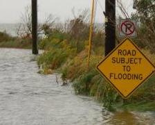
[dropcap style=”font-size:100px; color:#992211;”]T[/dropcap]here is a guilty voyeuristic frisson that comes from looking upon the almighty. Images of flooded subways and floating cars, whilst arresting, are nonetheless framed by a scale which is comprehensibly human. For a god’s-eye view, NASA provides.

NASA Goddard MODIS Rapid Response Team
On October 29, 2012 at 11 p.m. EDT, the center of Hurricane Sandy was just 10 miles (15 km) southwest of Philadelphia, Pennsylvania, near 39.8 North and 75.4 West. Sandy was still a hurricane with maximum sustained winds near 75 mph (120 kph) and moving northwest at 18 mph (30 kph). Sandy’s minimum central pressure had risen to 952 millibars. The hurricane-force-winds extended 90 miles (150 km) east of the center of circulation. Tropical-storm-force winds, however, went much further, as far as 485 miles (780 km).

Image: Betty Flowers
Source: NASA/Goddard Space Flight Center

The aim of art is to represent not the outward appearance of things, but their inward significance. – Aristotle